After getting stove fuel and food in Hilo, we headed southwest and up, to Hawai'i Volcanoes National Park. It was raining off and on the whole time, teasing us. It would start to clear up, then pour. We soon learned that was the norm on the east side of the mountains.
We turned off the highway and pulled in to the park entrance, where we showed our geezer pass, got a map, and asked the ranger if there was still space in the campground. He looked at us like we were from outer space, then figured out what we were asking (Are there any camping places left in the campground?), and said he didn't know, but there's usually plenty of space. We didn't realize there were two campgrounds, and the one we wanted (Namakanipaio) isn't inside the park gate; it's off the main highway, further on up four miles or so. Anyway, we drove out the crater rim road to where it was blocked off, at which point we looked closer at the map and discovered our error. Back out to the highway, on a few miles, and we were at camp.
Unlike other U.S. national park campgrounds we have stayed in, the Namakanipaio campground does not have assigned, individual camp spots. There's just a small area of mowed grass, some under big eucalyptus trees and some in the open; and you set up your tent wherever you please. There is also a communal pavalion with three fireplaces and about eight picnic tables. That's a great convenience since it's raining so often. The campground only had about five other parties with tents set up, so there was plenty of space.
It wasn't raining and there were still a couple of hours of daylight left, so we pitched the tent, threw in the sleeping bags and pads, then headed back to the main gate. We decided there was still time to hike through the Kilauea Iki crater. In spite of the rain, it was cool (as in fun).
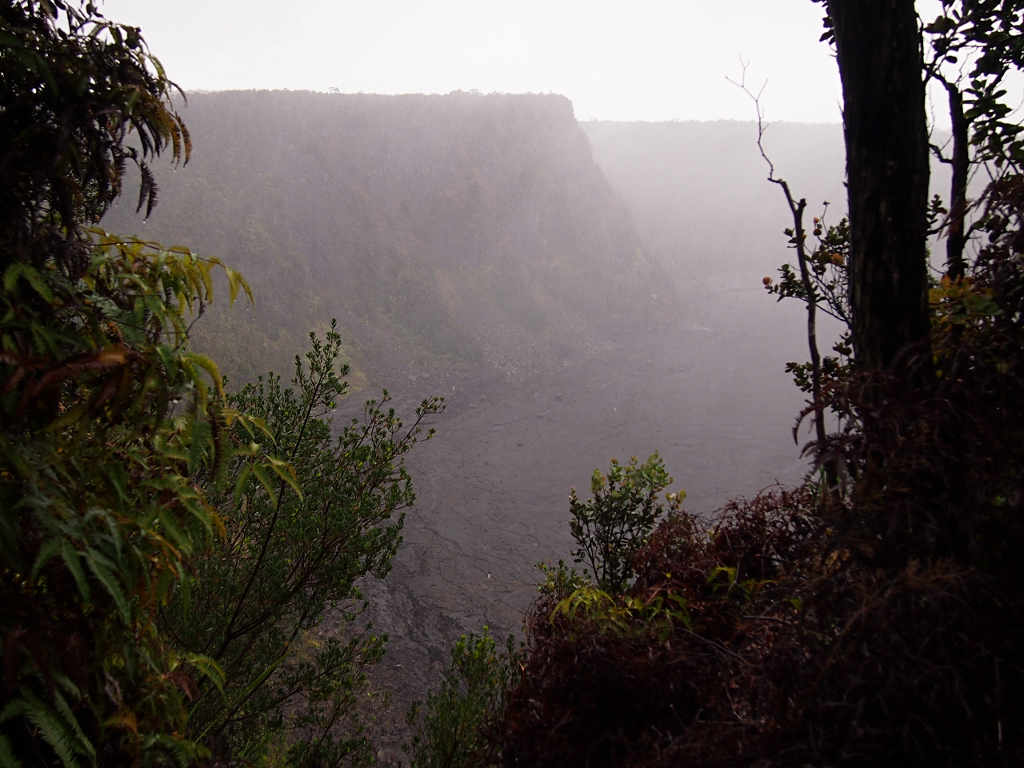
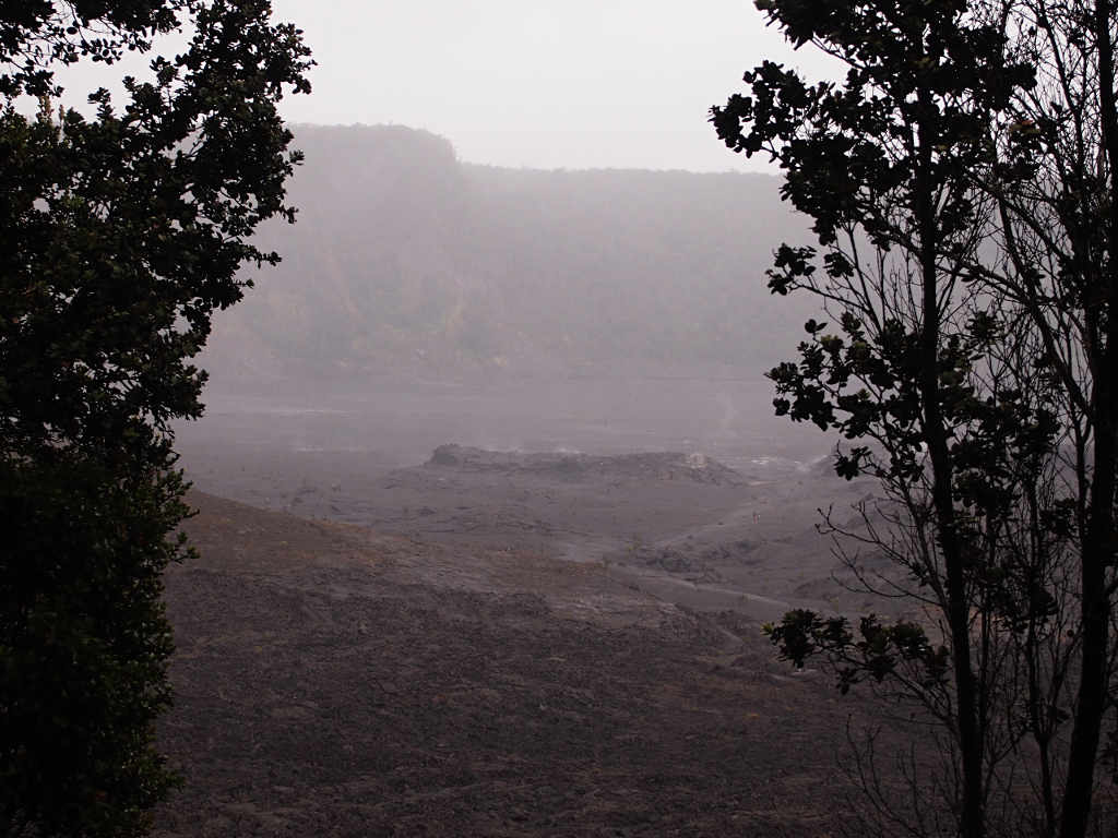
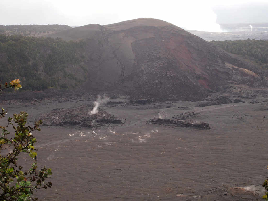
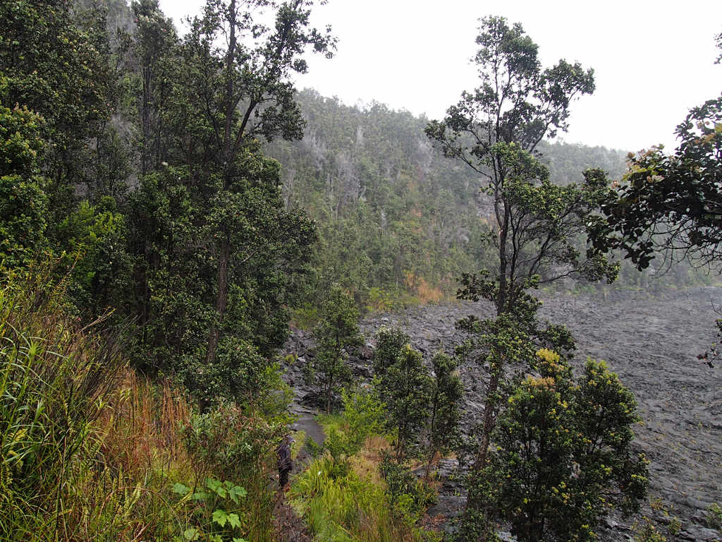
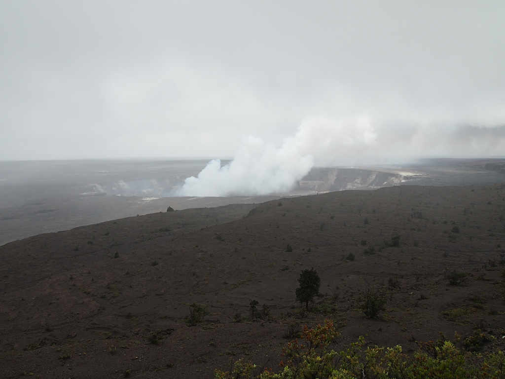
Kilauea Iki is a small crater off to the side of the main crater of Kilauea. It is separated from the main crater by a low ridge. From the air or on a map, they look like a big "Oh" with a little "oh" nestled up next to it. The trail starts out in temperate rainforest and winds along the rim of Kilauea Iki for a mile or so. It feels as if you've just landed on some distant planet, and are sneaking along trying to avoid discovery by any local inhabitants. You're looking out on a desolate scene, black lava shrouded in mist, with steam rising from various vents, and a few hardscrabble plants eeking out a living here and there in the harsh environment. In the distance, the main plume from Kilauea sent up a huge plume.
| |
|
| Kilauea Iki | Kilauea Iki |
 |
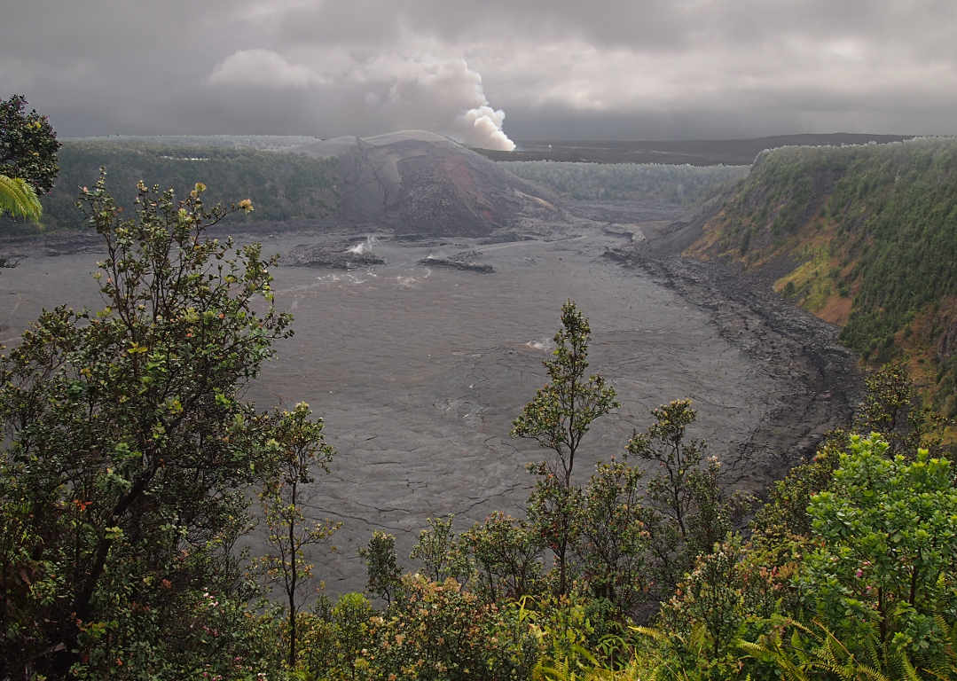 |
| Steam Vents in Kilauea Iki Crater | Kilauea Iki Crater with Kilauea Plume Beyond |
 |
 |
| Steam Vents in Kilauea Iki Crater | Kilauea Plume |
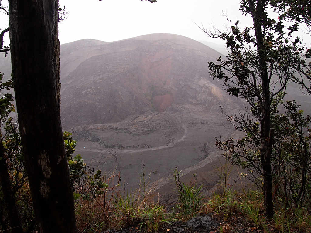
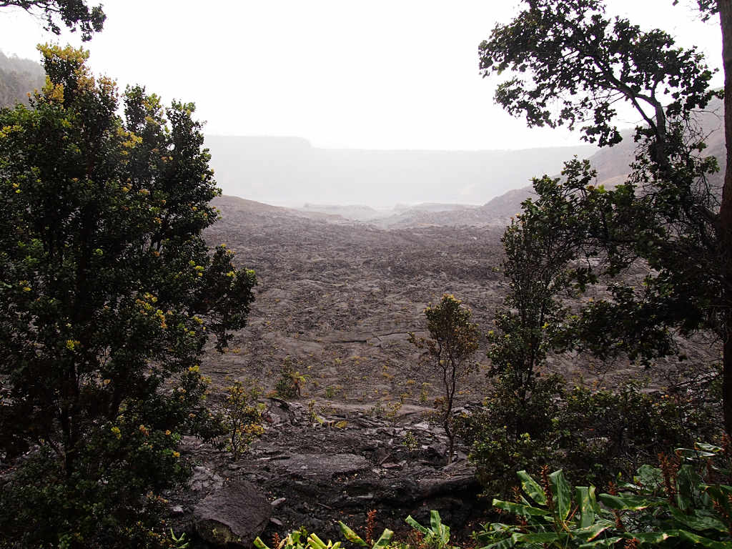
The trail followed the rim of Kilauea Iki around towards the main crater, at which point it descended the ridge separating Kilauea Iki from the main crater. In a few feet, we left the familiar rainforest and stepped onto what felt like a new planet.
 |
 |
 |
| Dona Descending
to the Crater Floor |
Forest / Crater Divide | Looking Out Onto the Crater Floor |
For those who are too young or don't remember, here's the story of Kilauea Iki, loosely translated from the interpretive sign:
After sitting on its butt and doing nothing for about 90 years, Kilauea Iki roared to life on the night of Nov. 14, 1959. During the next five weeks, spectacular fountains burst from the crater in 17 episodes lasting from one day to one week. Each episode flooded the crater with molten rock, creating a lake of lava 120 meters deep. (That's 400 feet for backwards U.S. citizens)
Scientists monitoring the volcano detected its amakening. The summit of Kilauea swelled for months, and seismographs recorded thousands of earthquakes as magma pushed toward the surface.
On the first day, lava poured from a fissure half-way up the crater's wall.
The eruption began when the south wall of Kilauea Iki ripped open in a "curtain" of lava 0.8 km (0.5 mi) long.
Torrents of molten rock cascaded into the 240 m (800 ft) deep crater, igniting the forest. Flames of burning trees flashed like giant sparklers, forming dots of bright light on the lava as it flowed across the floor of the crater.
Lava jetted skyward and rained back down into a deepening lava lake.
By the second day, jets of sulfurous gas blasted lava skyward from a single vent. Spectators used newspapers, umbrellas, and hats to shield themselves from the rain of hot cinders from the 580 m (1900 ft) fountain of lava.
With every fountain the lake rose like water filling a bathtub. Lava surging from the vent generated large waves, causing the lake to roll and pitch like ocean waves in a storm.
When the lake rose high enough to drown the vent, the fountain died. At the end of each episode, much of the ponded lava drained back down the vent, leaving a 15 m (50 ft) high "bathtub ring" of black rock on the crater wall. That rock ledge can be seen circling the crater floor today.
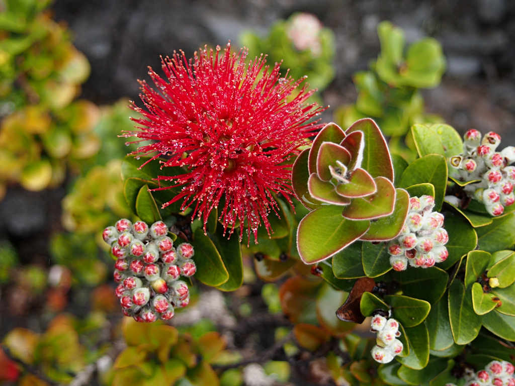
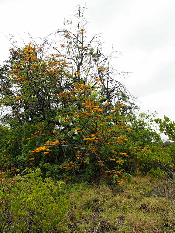
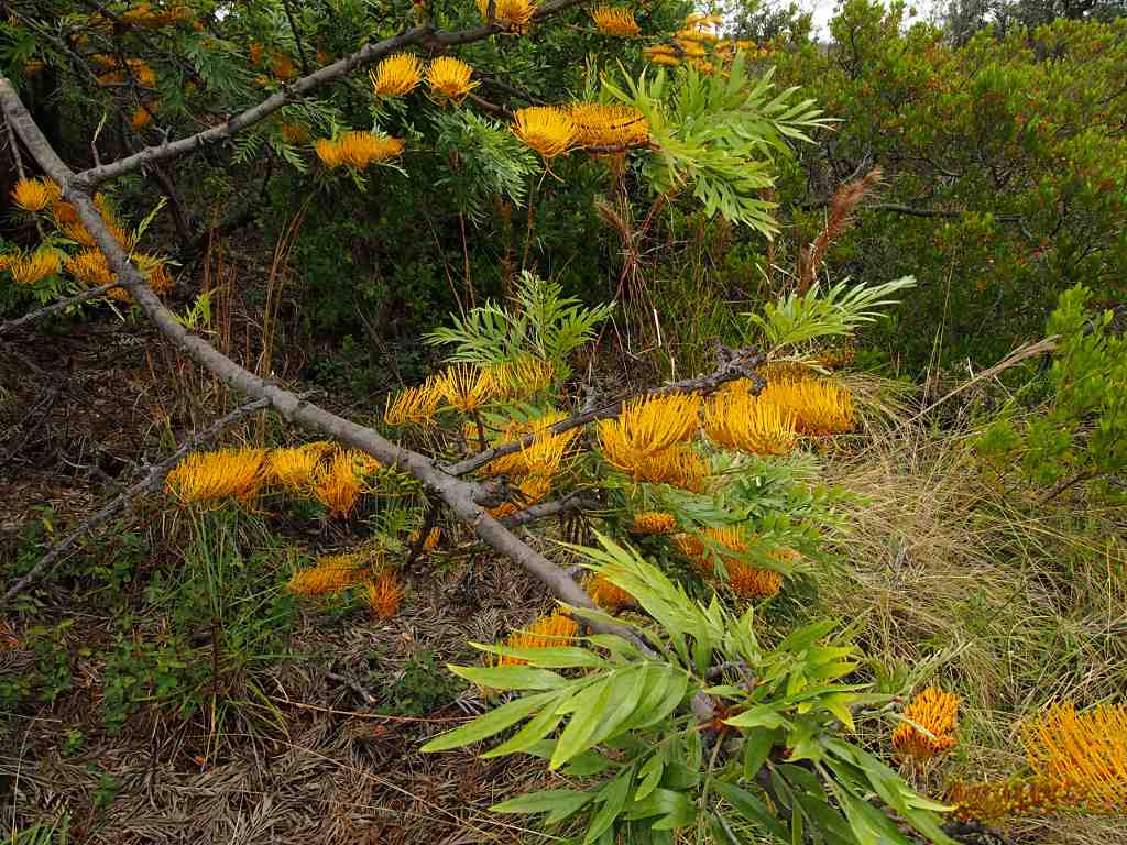
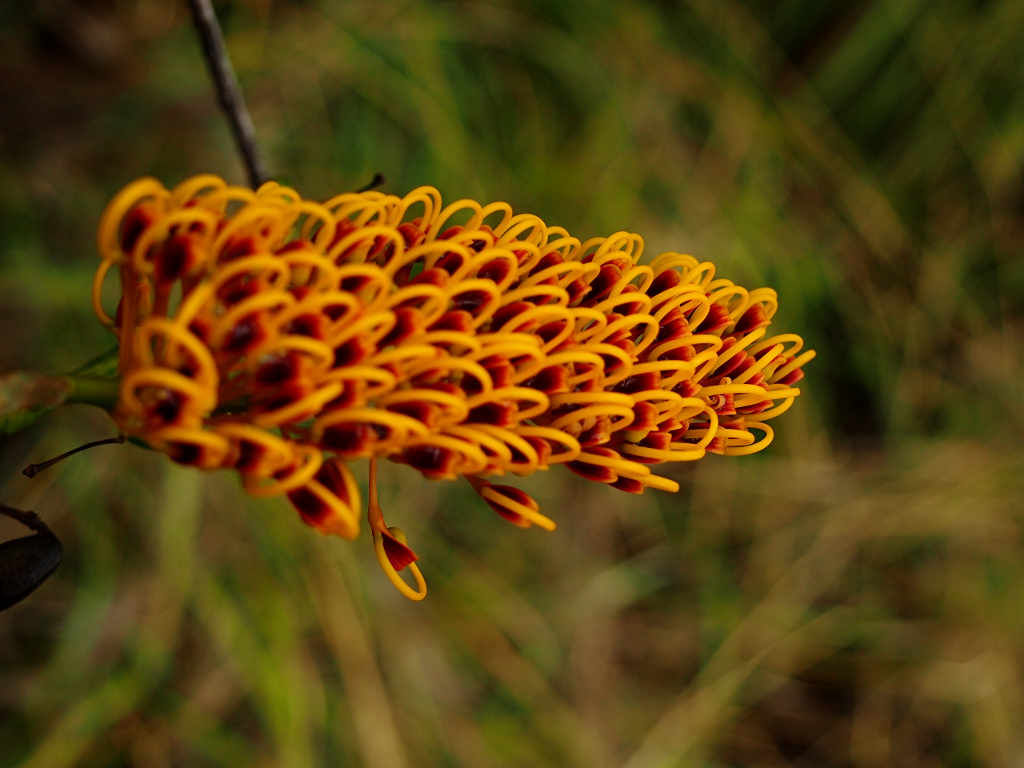
In spite of the harsh environment, the crater floor is being colonized. There were plants poking up every few meters. Most of them were the native 'Ohi'a lehua, Metrosideros Polymorpha. It is a slow-growing hardwood, the most abundant tree in Hawaii, and usually the first tree to colonize a lava flow. It sometimes starts as an epiphyte, and provides important habitat for native birds.
 |
 |
 |
| Metrosideros Polymorpha Tree
'Ohi'a lehua |
Metrosideros Polymorpha Blossom |
The lava looks kind of like a huge solidified pot of bubbling oatmeal. In places the shell of a lava tube has caved in, and you can see the void.
 |
| Lava Bubble |
 |
 |
 |
| Common Plant I can't Identify... | Colinization in amazing places | Metrosideros Polymorpha and Steam Vents |
 |
| Steam Vent |
We finished our hike through Kilauea Iki crater, then checked out the Thurston Lava Tube. It was a bit of a disappointment, as we were expecting more stalactite type formations, and the whole thing was artificially lit.
That evening when we were playing Bananagrams under the pavilion, another camper who was at the end of his trip gave us a full big bottle of fuel for the stove. You can't take it home with you on the plane, so it's a good idea to pass them along to someone else. We had been worried about whether or not we would have enough, given all the rainy weather and our desire to have hot drinks with everything. A Swiss couple also told us they had picked up a half-full bottle at a hostel in Hilo, so we got the name of it as a place to drop off any extras we had.
After a night of rain, we awoke to quiet (no rain) and the chirping of a few birds. We spent the morning on a liesurely hike at Kipukapuaulu, where we saw lots of Kalij Pheasants and some Apapane. Unfortunately, I didn't get a picture of an Apapane.
During our visit we kept an eye out for the Nene, or Hawaiian Goose, but didn't see any.
 |
 |
| Saffron Finch |
 |
 |
 |
| Kalij Pheasant |
 |
| Kalij Pheasant (Female) |
 |
| Japanese White-Eye |
There were cool trees all along this walk, including a number which had grown together over the years.
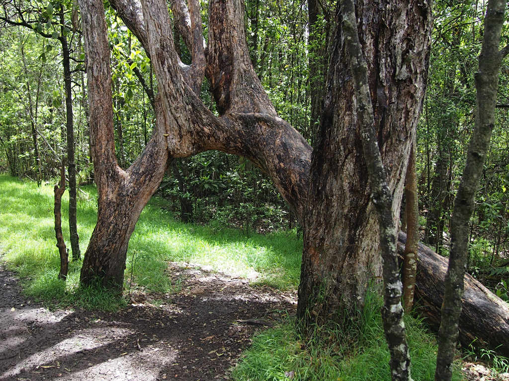 |
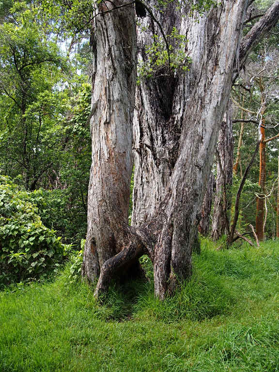 |
| Joined Trees |
At one point during our hike, I felt a substantial earthquake. I was really surprised when Dona said she didn't feel it. After our hike we drove as close as we could to the main crater, which isn't very close because the park service has everything near the crater blocked off, and you can no longer drive around the rim. I guess they are worried about everyone's health because of the gases being emitted. That seems like overkill to me; we should be responsible for our own health in that regard. When we went to the Jaggar Volcano Museum the next day they had a listing of the latest earthquakes, and the one that occurred during our walk was the largest in the past few days, a 4.9, centered down on the coast north of Hilo.
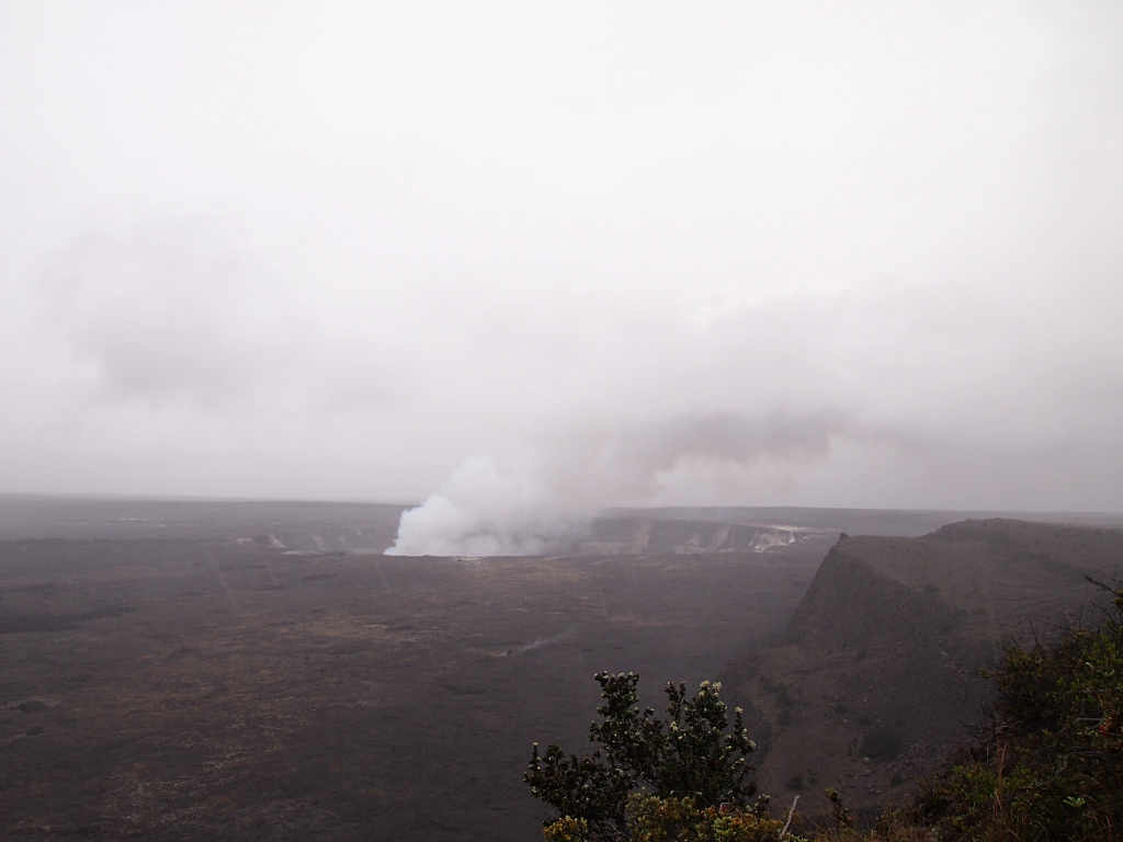 |
| Kilauea |
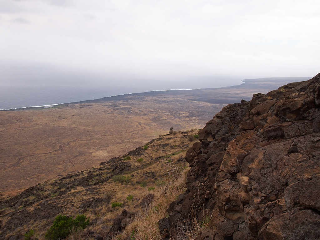
In the afternoon we drove out the Hilina Pali road. Wow! It winds through a dry, crazy landscape of lava and desert plants. There is another campground about half way down the road. It would be a fun place to camp, but you would need to bring your own water. It is probably drier than up where we camped...
 |
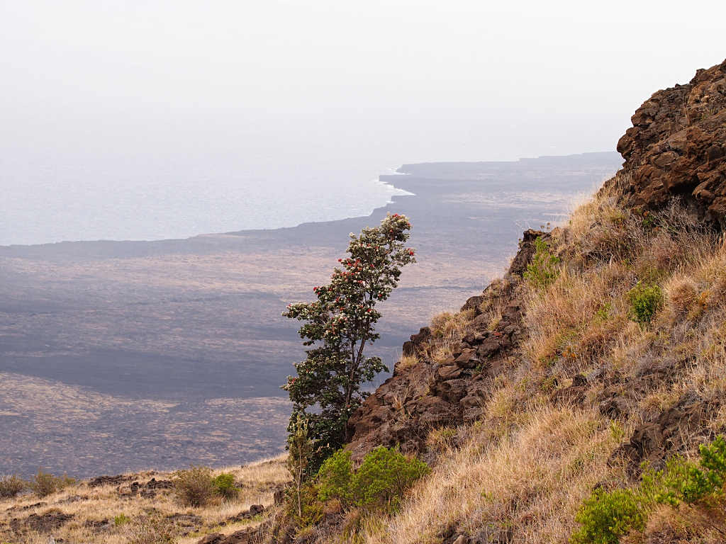 |
| Metrosideros Polymorpha | Metrosideros Polymorpha and the Coast |
 |
| Coast from End of Hilina Pali Road |
 |
 |
| Hmmm, what is it? | Lantana |
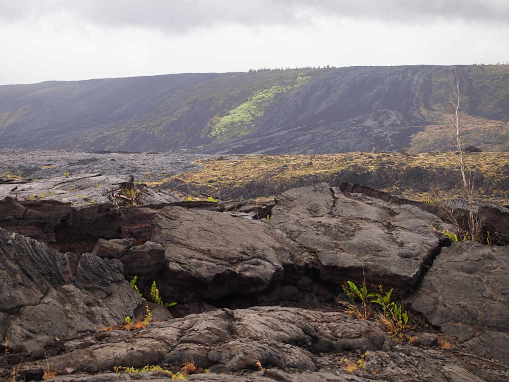
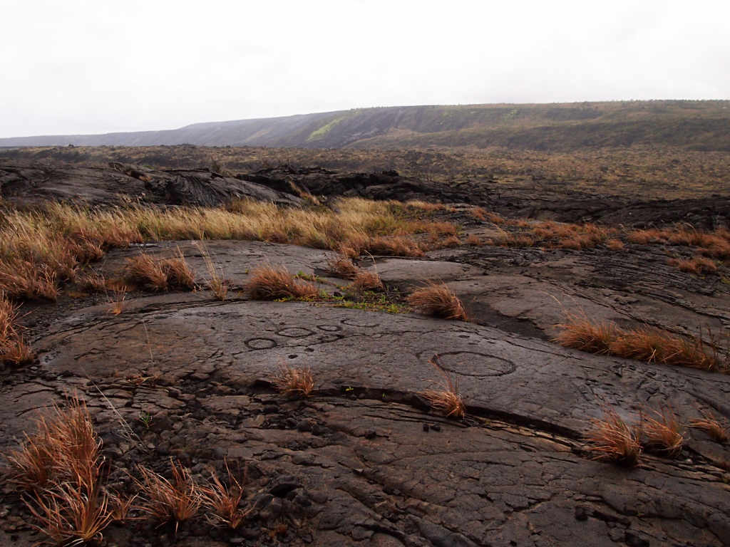
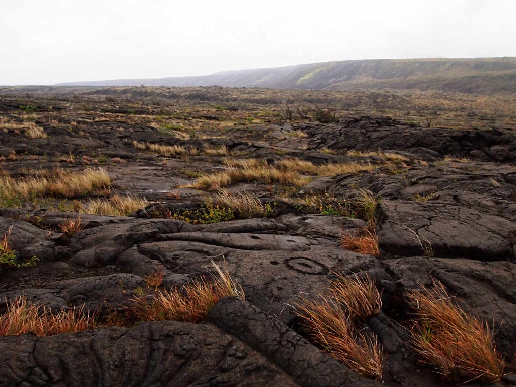
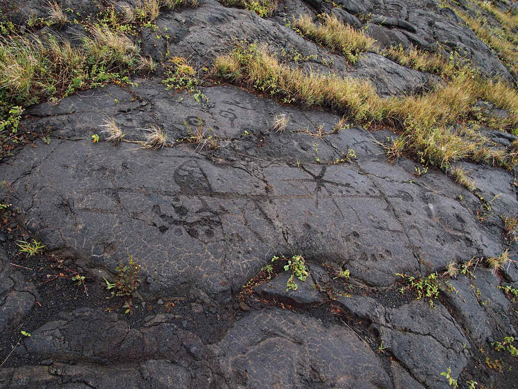
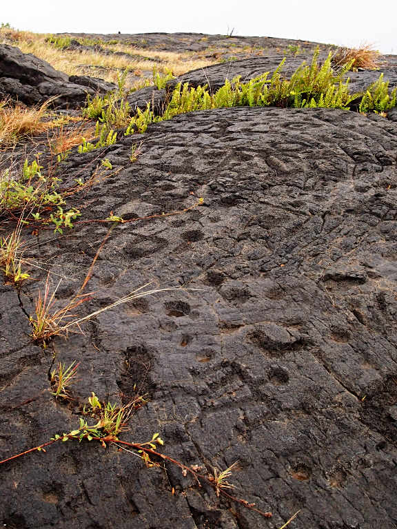
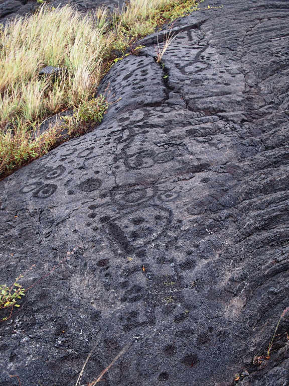
Then we worked our way on down the Chain of Craters Road, stopping to hike out to the PuuLoa Petroglyphs.
 |
| View upwards from Chain of Craters Road |
According to the interpretive sign,
"The name Pu'uloa (large hill) carries a kaona (hidden meaning) -- hill of long life. Families with genealogical ties to these lands come here to place the piko (umbilical cord) of their child. Their hope is that the mana (spiritual guiding energy) of Pu'uloa would bless that child with a long and prosperous life, and root them to their ancestral lands. Each puka (hole) is created to house a single child's piko. Of over 23,000 petroglyphs found at Pu'uloa, 16,000 are piko-related carvings -- a testament to the importance of both Pu'uloa and 'ohana (family).
"The design of each piko puka is as unique as the individual who created it. Some are carved deep, some shallow, while others are more extravagant, with multiple holes either in a circle, encircled, or as a line. These petroglyphs, regardless of style, unite generations of Hawaiian families past, present, and future."
Some of the petroglyphs were pretty elaborate, much like the cave paintings and petroglyphs in the American Southwest. But the majority of them were the simple holes. When I saw a series of holes in some obvious order I wondered whether they represented a particular line in the family.
 |
 |
| Pu'uloa Petroglyphs |
 |
 |
 |
 |
| Pu'uloa Petroglyphs |
 |
 |
| Dona Hiking in the Rain | Inside a Small Lava Tube / Pahoehoe Ripple |
There are two kinds of lava, "Pahoehoe" and "A'a". Pahoehoe is the stuff that looks like cake mix someone had jiggled that then set up in a hurry. It's relatively smooth. A'a is the harder stuff, all cracked and jagged.
 |
 |
 |
| Pahoehoe Lava |
I am always impressed with how tenacious and hardy native plants are. The Ohi'a trees seemed to pop up everywhere, and thing I think is nephrolepis exaltata, a sword fern, was often found nearby.
 |
 |
| Sword Fern (Nephrolepis exaltata) | Metrosideros Polymorpha Tree
'Ohi'a lehua |
The early Hawaiians had a heck of a time trying to live on this part of the island. Growing food here reminds me of what I've read of the Easter Island gardening. Because of the harsh climate, they would enhance small sheltered areas where soil could remain stable, and plant a small garden in that little cove. In this case, they were pits in the lava beds. From the interpretive sign:
Hawaiians, native to these ahupua'a (land divisions), lived a sustainable lifestyle through conservation and trade. They survived by living off the land and the sea. Although the mountains and the ocean provided ample pigs, fish, and other foods, this lava-covered lowland offered minimal soil and fresh water. This made the cultivation of the 'uala (sweet potato), a staple of the Hawaiian diet, difficult.
The mahi'ai (native farmers) created pits and carefully stacked rocks in the sheltered corners of lava flows to cradle the valuable soil and moisture required to grow the 'uala. These simple sweet potato mounds became their gardens. The mahi'a nurtured many gardens and controlled the number of 'uala that could be collected from them. The lives of the community depended upon this diligence, knowledge, and ingenuity.
 |
| Pit Garden |
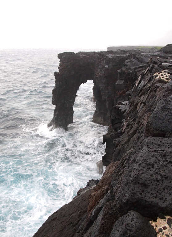
We continued from the petroglyphs on down to the coast, where we got a view of the Holei Sea Arch. It's impressive to see the lava cliffs dropping into the ocean. Too bad we didn't have any fresh lava flows doing that!
 |
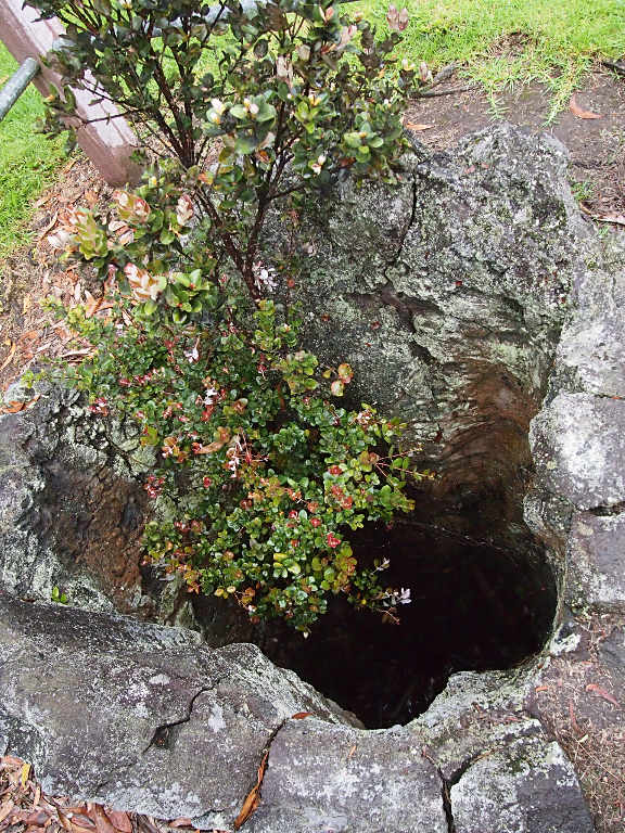
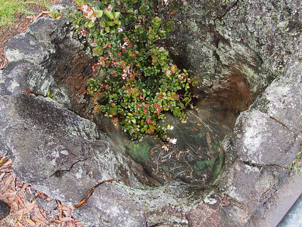
On our way back up we stopped to see some tree molds. When you think about it, it's pretty obvious... You have a big tree just sitting there, growing along, minding its own business. Then an upstart volcano goes and spews lava all over the place, flooding down the mountain and covering the land with three or more meters of hot rock. The poor tree gets surrounded and burned to death. What's left, if anything, eventually rots away, and you're left with a hole in the lava that looks like a three or more meter deep shallow well. A good reason to be careful when walking around at night.
 |
 |
| Tree Mold | Tree Mold (bottom enhanced) |
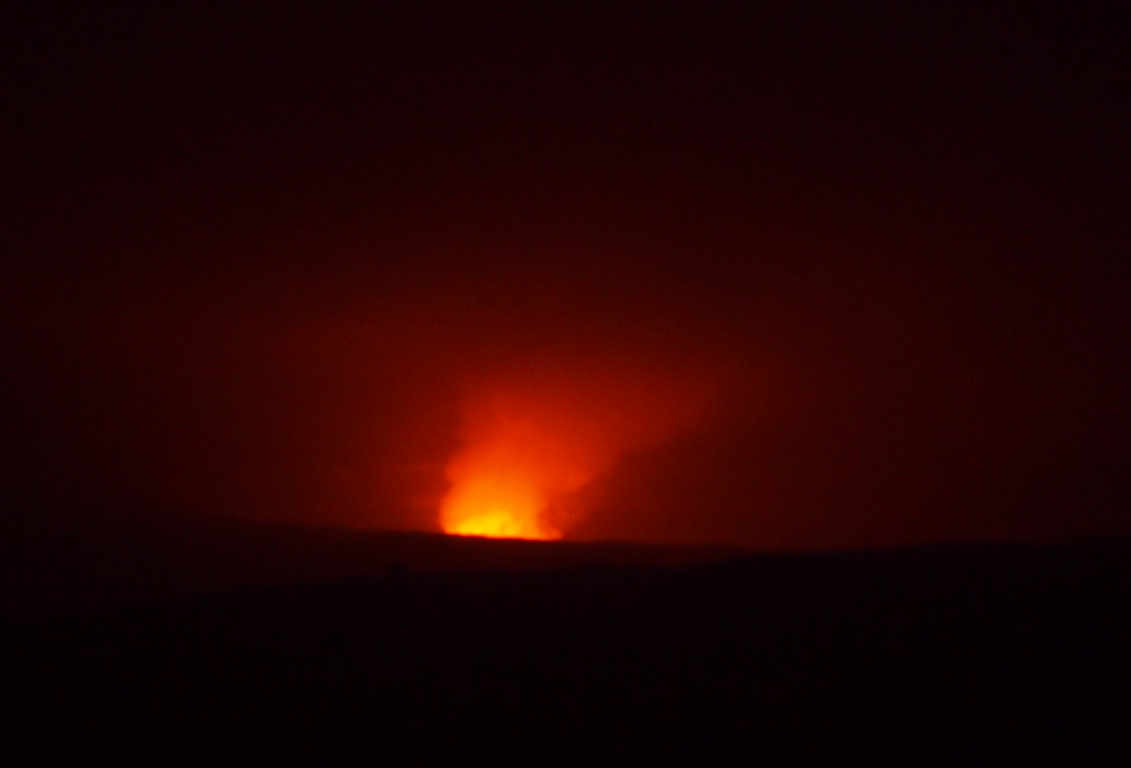
Once it got dark we went to see Kilauea again. It was impressive, but you really wanted to get over to the rim of the crater and look down on the whole thing.
 |
 |
| Kilauea from Jaggar Volcano Museum | Kilauea by daylight |
The next day we visited the art gallery by the visitor's center. They have a really nice collection of pieces by local artists. Some of the woodwork was exquisite, as were some of the paintings.
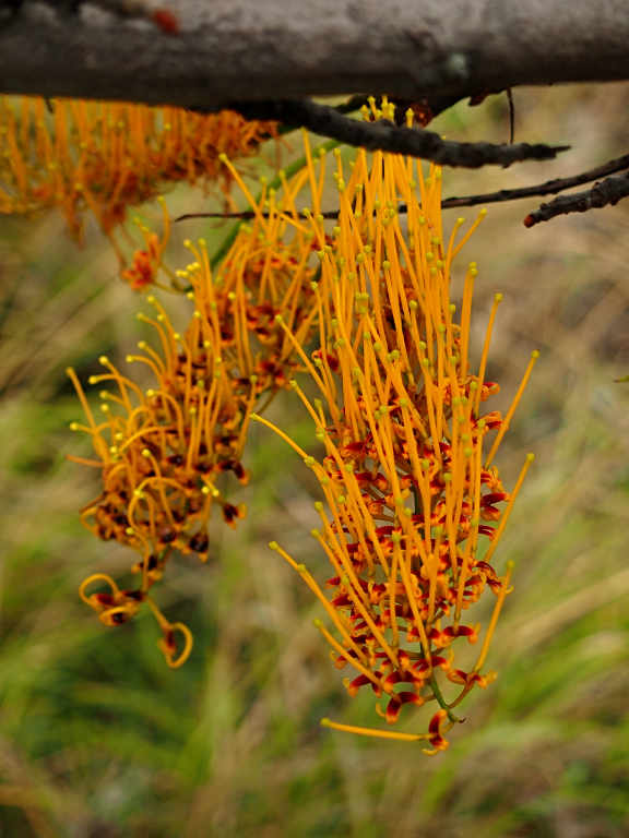
Then we headed southwest, out of the rain and towards drier country. Along the way we saw a number of Silk Oaks which took our fancy. Our next stop was Punaluu, recommended by Dona's nephew Ram for its black sand beach and green sea turtles.
 |
 |
| Silk Oak |
 |
 |
| Silk Oak |
This page last updated on 2013-10-23.
![]()